
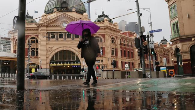
The temperature in Melbourne has dramatically dropped, with hail and strong winds on the way, along with snow in parts of Victoria.
A polar outbreak is set to bring plummeting temperatures and snow to southeast Australia this week.
An “interesting” week of weather has been forecast across the nation’s eastern seaboard, with an icy cold front expected to drop temperatures to below 10C in parts of Victoria and Tasmania.
Snow has been forecast to fall down to 1200m above sea level across the alpine ranges in Victoria late Tuesday and Wednesday, and down to 700m in the Tasmanian highlands.
A severe weather warning from damaging winds has been issued for northeast Victoria on Tuesday morning.
A road weather alert has also been issued for all Melbourne suburbs due to reduced visibility from rain during the late morning and afternoon that the weather bureau said would make driving conditions dangerous.


Up to 15mm of rain is forecast for Melbourne.
Weather bureau senior forecaster Richard Russell said the strong cold front would move through Victoria on Tuesday and reach Melbourne about lunchtime.
“It will be quite gusty initially but it will ease quite rapidly,” he said.
“The cold front will bring a band of rain mainly to southern and mountain parts of the state, we’re looking around 5-15mm of rainfall.
“When that change arrives, you’ll see that temperature plummet pretty quickly by about 5-7C.”
In Melbourne, the temperature is expected to drop from 18C to 11C by the mid-afternoon with localised hail also possible.
In the CBD, the mercury dipped from a high of 18.7C just before 10.40am, to just 14.9C at 11am.
The cold front is expected to clear the state by Wednesday morning, with dry conditions expected to return.
Sky News Weather chief meteorologist Tom Saunders said heavy falls were also expected to hit eastern tropical Queensland over the next few days.
“We’re looking at daily totals potentially over 100mm but perhaps even up to 250mm of rain every single day as we move through this week,” he said.
The weather bureau has issued a flood watch for the north tropical coast between Cooktown and Ingham with minor to moderate flooding “likely” from Tuesday.
“Many catchments within the flood watch area are now saturated and will therefore respond relatively quickly to further rainfall,” the bureau said.
“Localised flooding and disruption to transport routes are likely within the flood watch area.”
Source:News.com.au